
Masaya volcano hides two magma pools near 2 million people
Web StoryWatch this story in 15 seconds →Key takeaways
- Scientists found two hidden magma pools under Masaya volcano in Nicaragua.
- One pool seems to fill with fresh magma. The other seems to drain.
- About 2 million people live within 13 miles of the volcano.
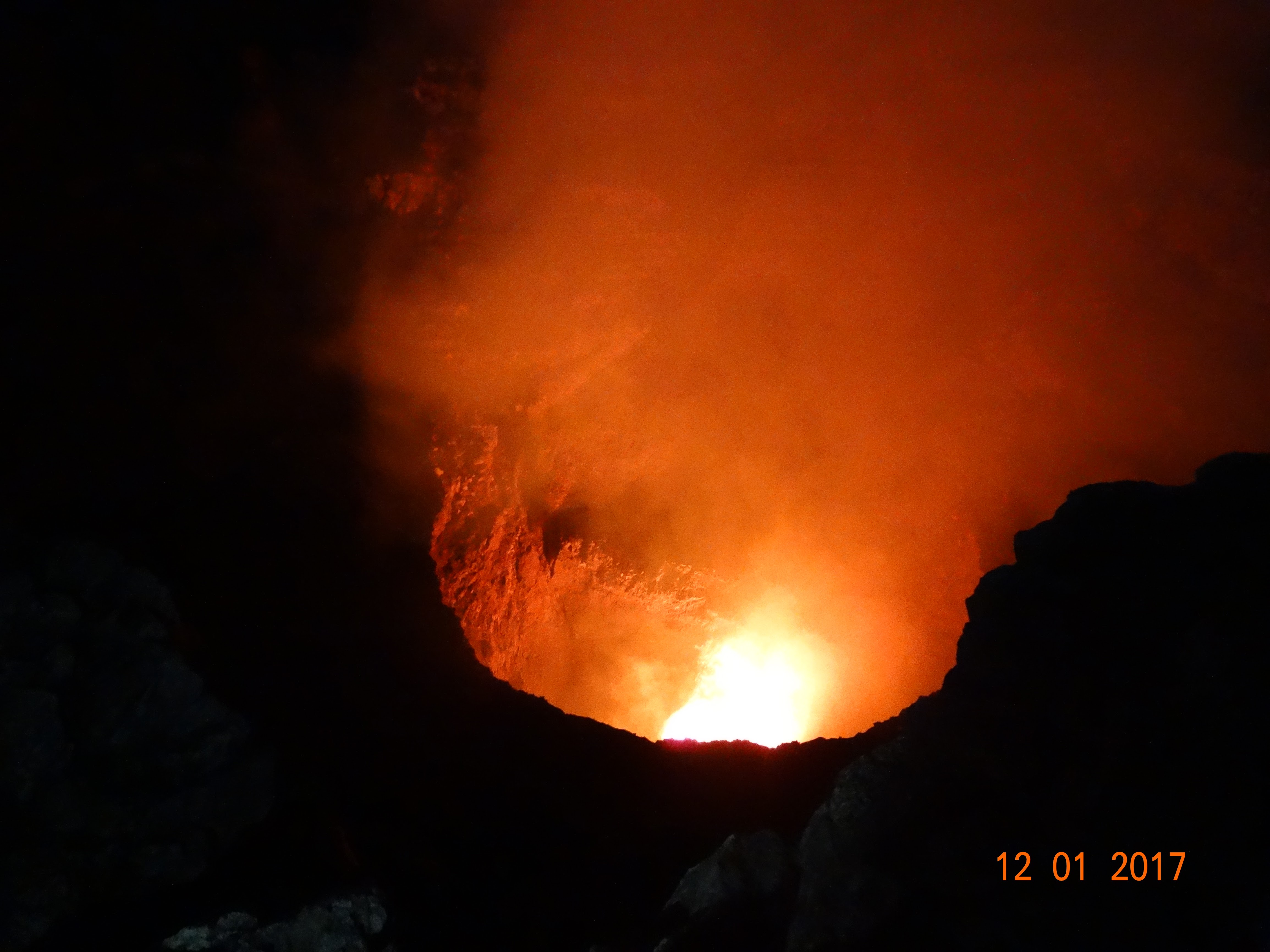
A volcano in Nicaragua hides a secret. It has two pools of hot rock deep below it. Scientists found them with six years of satellite data.
The volcano is Masaya. It sits near Managua, the capital of Nicaragua. About 2 million people live within 13 miles of it.
Its crater holds a lava lake that draws many tourists.
Magma is hot melted rock under the ground. It moves and pools in wide spaces. Those spaces are called reservoirs.
Masaya seems to have two of them. They act in different ways.
Searches for "volcano" jumped in the US and Britain this week. Google Trends data show the rise. The new Masaya study is one reason for the spike.
It gives a clear look at what sits under a live volcano.
What happened
A team at Penn State led the study. Lizzie Johnson was the lead author. She finished her degree in geosciences at Penn State in May.
She now studies volcanoes at the University of Hawaii.
Young Cheol Kim was a coauthor. He finished his doctorate at Penn State this summer. Johnson joined the group after a talk by Christelle Wauthier, a Penn State professor.
The team published its findings in Geophysical Research Letters.
The team did not dig into the volcano. It watched the ground from space. It used data from the Sentinel-1 satellite.
That satellite passed over Masaya about once every 12 days. It tracked the ground from 2018 to 2024.
The tool was a radar method called InSAR. It can spot tiny shifts in ground height. Radar waves pass through clouds.
That helps in the tropics, where clouds often cover the sky. By comparing radar scans over time, the team saw where the ground rose or sank.
The ground told two stories. First, the wide dip around the volcano sank. Then it began to rise.
A wide dip like this is called a caldera. It forms when ground sinks after magma leaves. When the ground rose again, the team read it as a sign.
Fresh magma may have entered a deep reservoir.
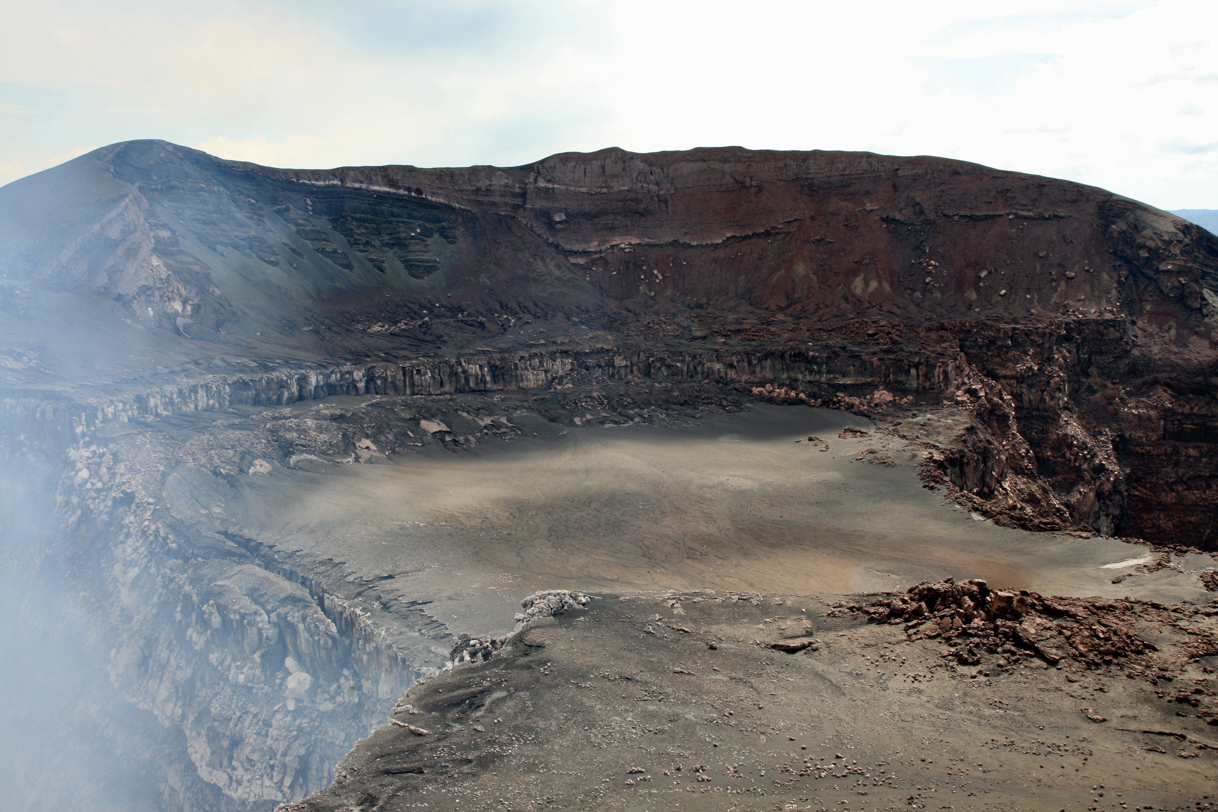
Second, the ground near Santiago crater kept sinking. Santiago is the active crater. It holds the lava lake.
It sank through the whole six-year study. It did not follow the same path as the rest of the caldera.
The team read this split as a sign of two pools. A deep pool may be filling with new magma. A shallow pool near Santiago may be losing magma.
The two pools seem to change on their own. That means the pipes under Masaya are more complex than past models showed.
Johnson said the work "may improve monitoring and eruption forecasting in the future." The team stressed one more point. The ground moves are clues, not proof of an eruption.
They show how magma moves, not when it will reach the surface.
Why it matters
Two million people live close to Masaya. That is the core reason this study counts. The volcano sits in a national park.
Tourists come to peer into its lava lake. Any change under the ground can touch many lives.
Gas is a daily risk, not just lava. Masaya lets out gas all the time. One gas is sulfur dioxide.
It can reach levels that harm health. This can happen even with no eruption. The volcano last made a major lava flow in 1772.
The gas risk never went away.
The new map of the pools helps with warnings. To warn people, scientists first need a baseline. A baseline is the normal pattern of a volcano.
When the ground strays from that pattern, it can flag a change. Kim said the aim is to warn people in good time.
The study also shows a wider problem. Volcanoes are hard to read. Their pipes sit deep and out of sight.
Earthquakes are hard to predict too. Both fields must read weak signals from the ground. Tools that detect quakes from far away help scientists watch the earth.
The same care applies to volcanoes.
There is one more reason the find counts. Masaya is not the only volcano with a lava lake. Other volcanoes hold lava lakes too.
What scientists learn at Masaya can help at those sites. It can sharpen how teams watch them.
The researchers found no sign of near-term danger. That point matters. The ground moves do not mean an eruption is near.
They mean the volcano has a more complex core than past work showed. People near Masaya face no new threat from this study alone.
What happens next
The team wants more watching. Longer satellite records can firm up the pattern. Computer models can test how the two pools link.
Both steps take time. Both steps can make warnings sharper.
More data can also test the split. Does the deep pool keep filling? Does the shallow pool keep draining?
Do the two pools trade magma? These are open questions. The answers sit in future scans.
Other volcano teams will watch this work. Lava-lake volcanoes are rare and risky. A method that works at Masaya can travel.
It can help teams that watch similar volcanoes in other lands.
For now, the message is calm and plain. Masaya has two magma pools, not one. One seems to fill.
One seems to drain. Scientists can now watch each pool on its own. That is a step toward better warnings.
It helps the 2 million people who live near the volcano.
Related stories

Why diamond is hard and graphite is soft when both are carbon
Diamond and graphite are both pure carbon, yet diamond is 10 on the Mohs scale and graphite is 1 to 2. The difference is not the atoms;
Why Hot Water Can Freeze Faster Than Cold: The Mpemba Effect Explained
Hot water can freeze faster than cold under specific conditions. The Mpemba effect, named for a 1963 schoolboy experiment, still divides

How Magnets Work at the Atomic Level: Spins, Domains, and Iron
Magnetism comes from electrons: their spin and orbits make each atom a tiny magnet. In iron, quantum forces align these atomic magnets into