
Seismographs Detect Earthquakes From Far Away: How They Work
Key takeaways
- A seismograph records ground motion, and distant quakes reach it as P waves, S waves, and surface waves arriving in that order.
- The gap between P-wave and S-wave arrivals reveals distance, since P waves travel faster than S waves.
- Three or more stations combine their distance estimates to pinpoint the epicenter by triangulation.
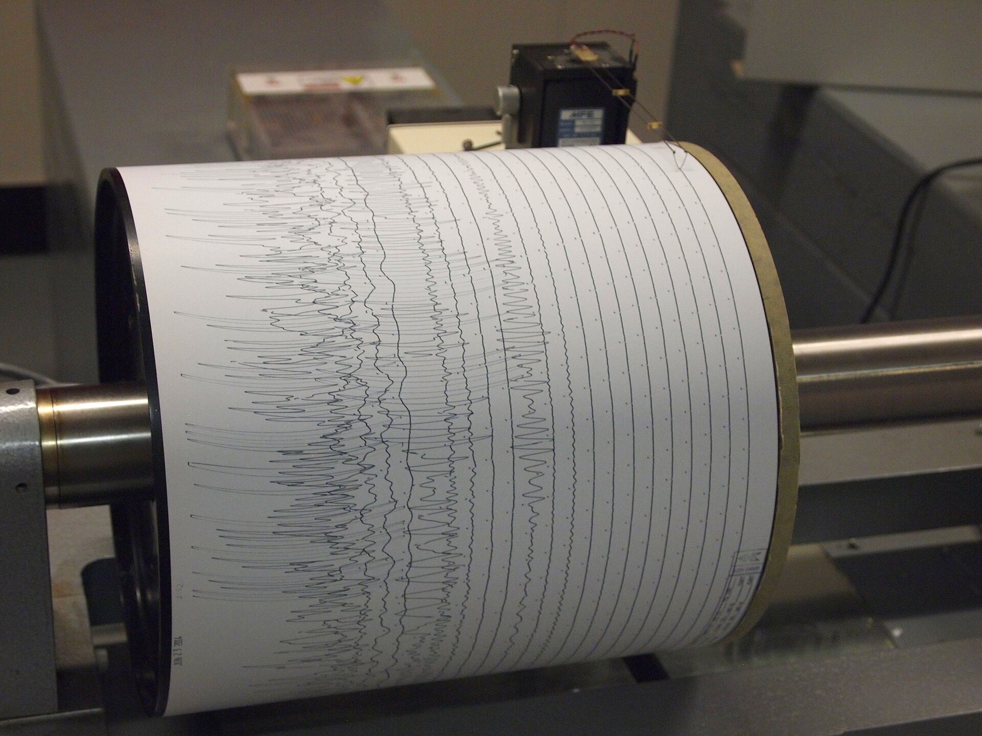
A seismograph is an instrument that measures ground motion. When an earthquake breaks rock along a fault, it releases energy as seismic waves, and those waves can travel through and around the whole planet before a distant instrument records them.
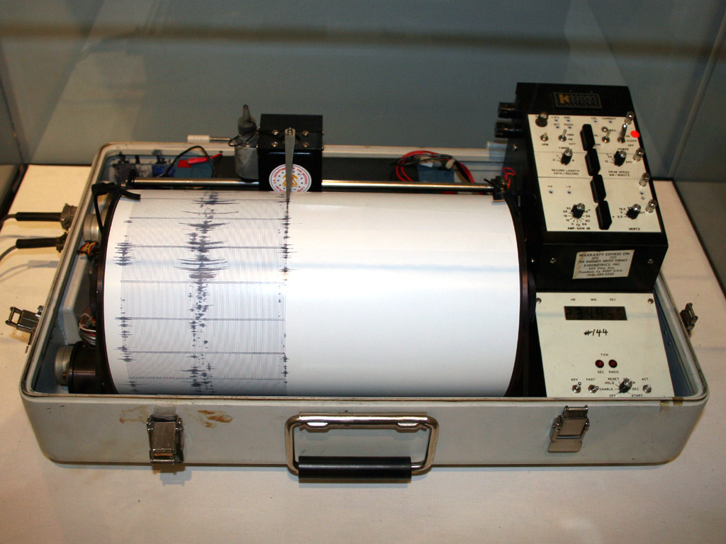
A seismogram is the graph a seismograph produces. It shows wiggles that grow, change shape, and fade as each wave type arrives, and trained analysts read those wiggles to work out where the quake happened and how big it was.
This article explains how seismographs detect earthquakes from far away, including how seismic waves travel, how arrival-time gaps reveal distance, how stations triangulate an epicenter, and why distant quakes still register.
What is a seismograph?
A seismograph works on a simple idea. A heavy mass hangs from a spring or pendulum, and it tends to stay still while the ground and the instrument frame move beneath it, so the relative motion between the mass and the frame traces the shaking.
Early 20th century instruments used pens on rotating drums of paper. Modern digital instruments use magnets and wire coils to measure ground motion, and they send data electronically, so analysts can examine records without visiting the instrument.
Typical stations measure vibration in three directions: north-south, east-west, and up-down. That three-part view helps analysts separate wave types and work out the direction the waves came from.
The principle is closer to a steady reference point than to a microphone. The mass resists motion, the ground moves, and the difference between the two becomes the record.
How seismic waves travel
An earthquake sends out two kinds of body waves through the interior of the Earth. P waves, or primary waves, are compressional waves that push and pull rock in the direction of travel, much like sound waves move through air. S waves, or secondary waves, are shear waves that shake rock side to side, perpendicular to the direction of travel.
P waves are the fastest seismic waves. According to the US Geological Survey (USGS), S waves in rock generally travel about 60 percent of the speed of P waves, so the S wave always arrives after the P wave.
The two wave types also differ in what they can pass through. P waves travel through solids, liquids, and gases, while S waves cannot travel through liquids or gases because fluids cannot carry shear stress. That difference is why S waves are blocked by the liquid outer core and leave a shadow zone on the far side of the planet.
Penn State class notes put typical speeds at about 1 to 14 kilometers per second for P waves and about 1 to 8 kilometers per second for S waves, depending on the rock. Speeds generally rise with depth because pressure increases, even though rising temperature works the other way.
Surface waves form when body waves reach the surface. Love waves shake the ground side to side, and Rayleigh waves roll the ground in an elliptical motion, similar to ocean waves. Surface waves are the slowest arrivals, yet they often cause the strongest shaking, which is why they matter for damage even though they arrive last.
How the arrival-time gap reveals distance
P waves and S waves leave the quake at the same time, but P waves pull ahead as they travel. The farther a station sits from the quake, the longer the delay between the P-wave arrival and the S-wave arrival on its seismogram.
Analysts measure that gap, called the S minus P time, and compare it with known wave speeds to estimate distance. For shallow quakes at distances of about 50 to 500 kilometers, Penn State notes a handy rule of thumb: the distance in kilometers is about eight times the S minus P time in seconds, using P waves near 8 kilometers per second and S waves near 3.45 kilometers per second.
One station gives distance but not direction. The quake could sit anywhere on a circle around the station with that distance as its radius, so a single seismogram alone cannot fix the location.
That circle idea is the key to the whole method. Each station draws one circle, and the quake must lie on every circle at once.
How three stations pinpoint the epicenter
Three or more stations are needed to locate an epicenter by triangulation. Each station turns its S minus P gap into a distance, and each distance becomes a circle centered on that station.
The circles cross at one spot, and that spot is the epicenter, the point on the surface directly above the focus where the rupture started. In practice, analysts solve the problem in three dimensions with spheres, which also yields the depth of the focus.
Modern networks make this fast. Electronic links between stations and computers mean locations can be calculated quickly after a quake, and news reports follow soon after.
The method also explains why networks matter more than any single instrument. One station hears a distant quake, but a network locates it.
The same wave physics that locates quakes also reveals the inside of the planet. Waves bend, reflect, and speed up as they cross boundaries between crust, mantle, and core, so travel times carry clues about what lies below, much as dark matter research uses indirect signals to map something unseen.
Why distant quakes still register
Seismic waves lose strength as they spread. Body waves spread through the volume of the Earth and fade quickly, while surface waves spread only along the surface, so their energy stays in a smaller volume and their amplitude stays larger at distance, according to the USGS.
That is why a large quake can be recorded on the other side of the planet. The 2011 magnitude 9.0 earthquake in Japan, for example, produced dramatic traces on seismographs around the world.
Sensitive instruments help too. A quiet station on stable rock can pick up tiny ground motions that a person would never feel, and networks filter out local noise from traffic, wind, and ocean waves.
Distance also stretches the seismogram out. Near a quake, the wave types pile on top of each other, while far away they separate in time, which makes the P, S, and surface wave arrivals easier to read.
In short, distant detection is not magic. It is patient listening plus physics, with waves that outrun human senses and instruments that remember every wiggle.
How scientists measure earthquake size
Location answers the first question after a quake, and size answers the second. Magnitude describes the energy released at the focus, while intensity describes how strongly the shaking was felt at a place.
The Richter scale is the best known magnitude scale, but most agencies no longer use its original method. It was built for Southern California quakes on older instruments, and it struggles with very large or very distant events.
One Richter unit still gives a useful sense of scale. A magnitude 6 quake shakes the ground about ten times more than a magnitude 5 quake, but it releases about 32 times more energy, according to Maricopa Open Textbooks.
Modern agencies generally report moment magnitude, which estimates energy from the rupture area, the amount of slip, and the stiffness of the rocks. Moment magnitude numbers run close to Richter numbers for most quakes, and they stay more accurate for the largest ones.
That size estimate, like location, depends on the same global network. More stations mean better averages and fewer blind spots, which is one reason the network keeps growing.
The global network behind distant detection
No single country hears every quake alone. The International Registry of Seismograph Stations lists more than 26,000 seismographs on the planet, according to Maricopa Open Textbooks.
The Global Seismograph Network is a smaller set of more than 150 stations that meet strict design and precision standards and share real-time data electronically. It helps monitor for nuclear tests under the Comprehensive Nuclear-Test-Ban Treaty Organization, and it supports tsunami warnings.
Regional arrays add detail closer to home. The USArray, for example, used hundreds of permanent and portable seismographs across the United States to map subsurface structure by passively collecting waves from quakes.
That layered setup, local stations plus regional arrays plus a global backbone, is what turns a faint wiggle into a located, sized, and reported earthquake. The human side of the work is slower than the waves, yet the instruments never blink, unlike the quirks of how time feels in emergencies.
Frequently asked questions
How far away can a seismograph detect an earthquake?
It depends on the quake size and the station noise level. Small quakes may register only nearby, while great quakes above magnitude 8 can be recorded around the world by the global network.
Why do P waves arrive first?
P waves travel faster than S waves and surface waves. Since all wave types leave the quake at the same time, the fastest waves reach any station first, followed by S waves and then surface waves.
Can one seismograph locate an earthquake?
No, not on its own. One station can estimate distance from the S minus P gap, but it cannot fix direction, so at least three stations are needed to triangulate an epicenter.
What is the difference between the focus and the epicenter?
The focus is the point inside the Earth where the rupture starts. The epicenter is the point on the surface directly above the focus, and it is the location most news reports give.
Do seismographs predict earthquakes?
No. Seismographs detect and locate quakes after they happen, and networks help with rapid warnings for shaking that is still on its way, but they do not predict quakes days ahead.
The bottom line
Seismographs detect faraway earthquakes by recording seismic waves that race through the planet at kilometers per second. The P-to-S arrival gap gives distance, three or more stations give location, and wave amplitude gives size, all backed by a global network of thousands of instruments.
If you want to dig deeper, compare the USGS body-wave explainer with the Maricopa textbook chapter, and try reading a real seismogram with P, S, and surface arrivals marked. The wiggles stop looking random once you know what each packet means, and the same habit of checking primary sources helps when reading about fingerprints or lie detector tests.
Tags: seismographs, earthquakes, seismic waves, geology
Latest in Science
- What is dark matter, explained without jargon
- Why does time feel slower during emergencies
- Why do we have fingerprints and what are they for
- How do lie detector tests work and why are courts skeptical
Subscribe for one clear science explainer each week, with sources you can check.
Related stories

Why diamond is hard and graphite is soft when both are carbon
Diamond and graphite are both pure carbon, yet diamond is 10 on the Mohs scale and graphite is 1 to 2. The difference is not the atoms;

Why Hot Water Can Freeze Faster Than Cold: The Mpemba Effect Explained
Hot water can freeze faster than cold under specific conditions. The Mpemba effect, named for a 1963 schoolboy experiment, still divides
How Magnets Work at the Atomic Level: Spins, Domains, and Iron
Magnetism comes from electrons: their spin and orbits make each atom a tiny magnet. In iron, quantum forces align these atomic magnets into