
How scientists know what is inside the Earth
By Rive News / Research desk | Rive News / Published October 27, 2026 at 9:00 AM PKT
Key takeaways
- Earthquake waves act like scans of the planet, bending and stopping in ways that reveal hidden layers.
- S waves cannot pass through liquid, so their disappearance beyond the mantle proves the outer core is liquid.
- Density, meteorites, and the magnetic field support the seismic picture of an iron-rich core.
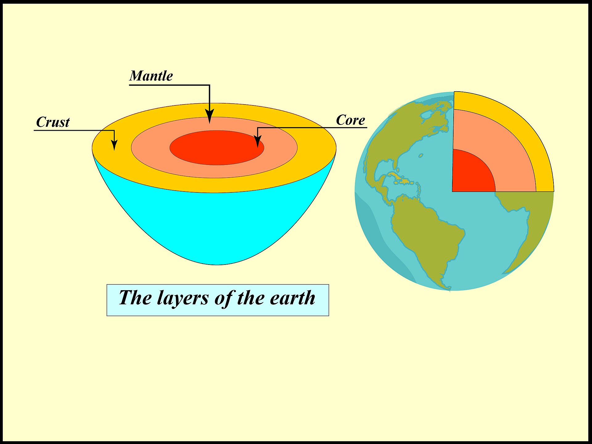
A model of the layers of the Earth, from the thin crust down to the core. Photograph: the Earth layer model
Image Credits: Wikimedia Commons
Scientists know what the inside of the Earth looks like without ever seeing it directly. They read earthquake waves the way doctors read scans, watching how vibrations bend, speed up, slow down, or vanish as they pass through the planet. Those patterns, checked against density, magnetism, and rock samples, build the layered picture taught today.
This article explains how earthquake waves reveal the interior, what each major layer is, and how the supporting evidence fits together. It covers seismic waves, the shadow zone, the core, the mantle, and the limits of what drilling can reach.
Earthquake waves as a scanning tool
Earthquakes release two main kinds of body waves that travel through the planet. P waves, or primary waves, are compression waves that move through solids and liquids alike, squeezing and stretching material as they pass. S waves, or secondary waves, are shear waves that move material from side to side, and they can travel only through solids.
Seismographs around the world record when each wave arrives after a quake. Because wave speed changes with the density and stiffness of the material, a wave that speeds up or slows down has entered different ground. When waves meet a sharp boundary between different materials, some energy reflects and some refracts, or bends, which lets scientists locate the boundary.
Geosciences LibreTexts explains that the reflections and refractions of seismic waves allow the layers and boundaries within the Earth to be located and studied. Over decades, thousands of quakes recorded at thousands of stations built a consistent global model. No single earthquake proves the model, but the same pattern repeats no matter where the quake happens.
The shadow zone and the liquid outer core
The strongest single clue to the core comes from a gap in the records called the shadow zone. P waves are not picked up directly by seismographs between 104 and 140 degrees from an earthquake, because the liquid outer core bends them away. S waves vanish even more dramatically, since they cannot travel through liquid at all.
The boundary sits about 2,900 kilometers below the surface. P waves slow down there, showing that the outer core is less rigid than the mantle above it. S waves stop there entirely, which is the direct evidence that the outer core is liquid rather than solid.
The size of the shadow zone also measures the core. If the core were smaller, the zone where waves go missing would shrink, and if it were larger, the zone would grow. Seismologists use that geometry, together with arrival times, to place the core-mantle boundary and to estimate the core's size.
The solid inner core
A solid inner core was discovered through faint waves that should not have been there. In 1936, Danish seismologist Inge Lehmann found weak P waves inside the shadow zone and explained them with a separate inner core that reflected them. Later studies confirmed that the inner core transmits waves in a way only a solid can.
The inner core sits under enormous pressure, which keeps its iron and nickel alloy solid despite extreme heat. NASA estimates cited in recent summaries put temperatures there at up to about 5,400 degrees Celsius. Pressure, not coolness, is what holds the solid together.
Modern work sharpens this picture further. "This approach allows fast, reliable and robust teleseismic phase processing. It enables us to extract more meaningful data, helping us better understand the physics and dynamics deep inside the Earth," said Congcong Yuan, a postdoctoral researcher at Cornell University, describing a deep-learning workflow for picking faint distant earthquake phases.
Each improvement in reading faint waves refines the map of boundaries deep underground.
The mantle and the crust
Above the core lies the mantle, the thickest layer and the largest by volume. It is solid rock, but under heat and pressure it can deform slowly over geological time, which is why it is sometimes described as plastic. Mantle movement drives the slow motion of tectonic plates at the surface, which in turn causes earthquakes and volcanic eruptions.
The boundary between the crust and the mantle is called the Mohorovicic discontinuity, or Moho for short. Croatian seismologist Andrija Mohorovicic identified it in 1909 from an abrupt increase in seismic wave speed. That speed jump marks where thin crust gives way to denser mantle rock.
The crust itself is the thinnest layer and the only one humans live on. Oceanic crust is thin and dense, while continental crust is thicker and lighter. Seismic waves show this contrast clearly, which is why scientists can state crust thickness with confidence even though no drill has come close to the mantle.
What supports the seismic picture
Seismic waves carry the main evidence, but four independent checks support the same model. First, the Earth's mean density is about 5,513 kilograms per cubic meter, far higher than surface rocks alone can explain. A dense iron-rich core is needed to balance the average.
Second, meteorites offer samples of early solar system material. Iron meteorites resemble what the core is thought to be made of, while stony meteorites resemble mantle rock. Together they support a planet that separated into layers as it formed and heated.
Third, the magnetic field points to a moving, electrically conducting interior. The outer core is thought to be responsible for generating the field through the motion of liquid iron and nickel. No solid, still interior could sustain that field in the same way.
Fourth, volcanoes and deep rocks bring fragments of the upper mantle to the surface. Those samples match the densities and compositions that seismic speeds predict. The pieces agree with each other, which is why the model survives even though direct access stops shallow.
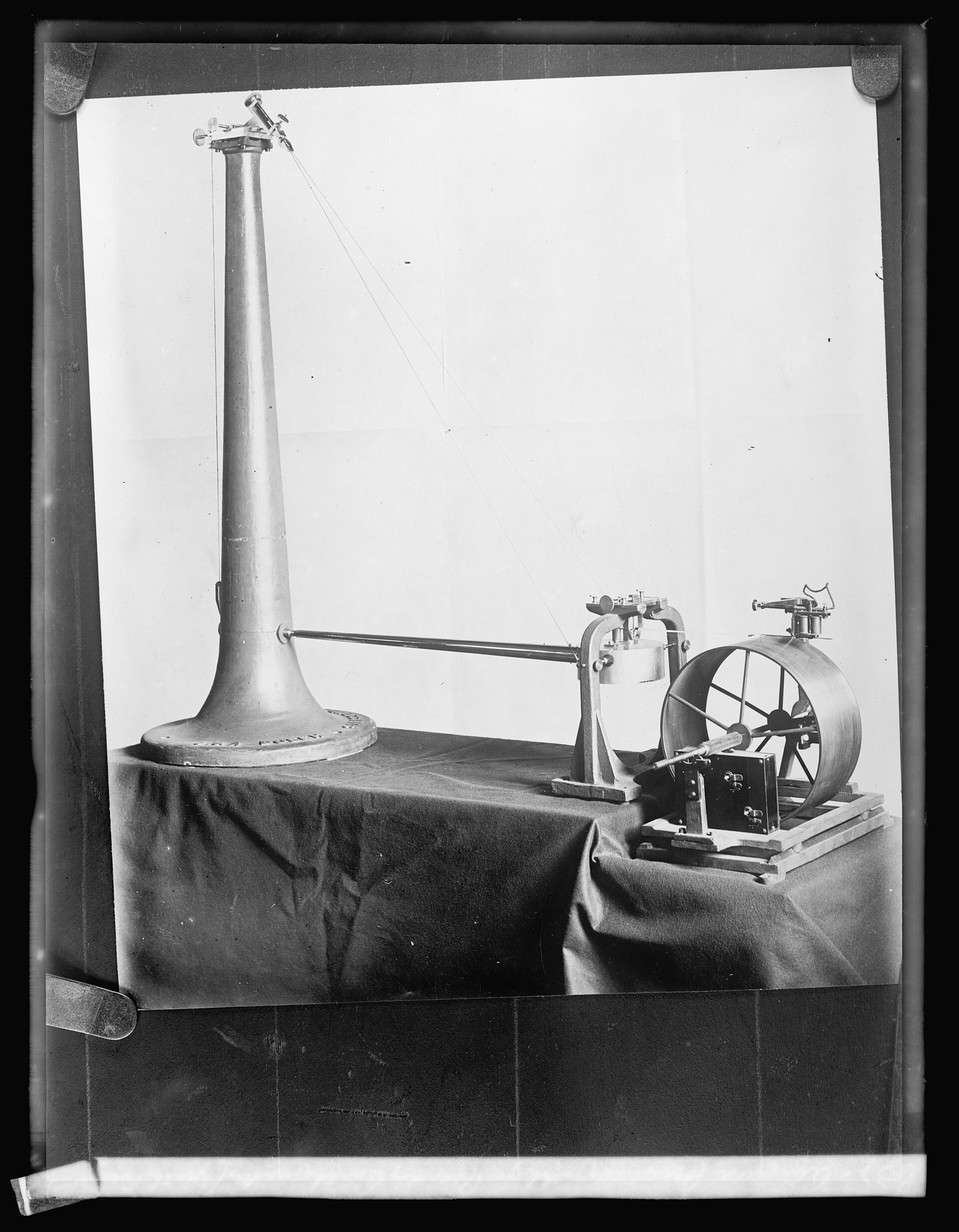
A historic seismograph for recording earthquake waves, an early tool of the science. Photograph: the historic seismograph
Image Credits: Wikimedia Commons
How far drilling actually reaches
Direct sampling ends very close to the surface. The deepest drill hole ever made reaches just over 12 kilometers down, which is under 0.2 percent of the roughly 6,371 kilometer journey to the center. Heat, pressure, and rock hardness make deeper drilling impractical with current technology.
That limit explains why indirect evidence matters so much. Scientists cannot visit the mantle, let alone the core, so they triangulate from waves, density, magnetism, meteorites, and lab experiments. In labs, researchers squeeze minerals to core pressures and measure how waves move through them, then compare those results with real earthquake records.
The timeline of discovery shows the method working layer by layer. Oldham identified the core in 1906, Mohorovicic found the base of the crust in 1909, Beno Gutenberg located the core-mantle boundary in 1914, and Lehmann discovered the inner core in 1936. Each date marks a wave pattern that refused to fit the simpler model before it.
Frequently asked questions
Why can scientists not just drill to the center?
Temperature and pressure rise so fast with depth that drill bits fail and boreholes collapse long before the mantle. The deepest hole, just over 12 kilometers deep, stopped far short of even the crust-mantle boundary in most places. Drilling also gets slower and costlier with every kilometer, while seismic data already covers the whole planet.
How do scientists know the core is made of iron?
Density gives the first clue, since the planet as a whole is denser than its surface rocks. Iron meteorites provide a second clue, as samples of the material that built the planets. Lab tests add a third, showing that iron alloys under core pressure transmit waves at speeds matching real earthquake records.
What would change the current model?
New wave data could shift a boundary depth, reveal extra layers, or refine compositions, and seismology has done all three before. A wholesale replacement would need to explain the shadow zone, the density, and the magnetic field at once. Competing models are tested against those same records, which keeps the picture honest.
Do other planets get studied the same way?
Yes, where quakes or marsquakes can be recorded. Seismometers on Mars have already returned data about that planet's interior, using the same principle of reading wave arrivals. The method travels well because it needs only vibrations and clocks, not a drill.
The bottom line
Scientists map the Earth's interior by listening to earthquakes, not by digging to the core. P waves bend, S waves stop at liquid, and the shadow zone sizes the core, while density, meteorites, and magnetism confirm the result. The picture will keep gaining detail, but its main layers rest on evidence that has been checked from many directions at once.
Tags: earth science, seismic waves, earth interior
Rive News is a research desk that writes plain-language explainers from public sources, with no invented experts or first-hand claims.
Related
- What causes earthquakes and can we predict them
- How do earthquakes happen and why do some places get more of them
- Seismographs detect earthquakes from far away: how they work
- How a compass finds north using Earth's magnetic field
Subscribe for one plain-language science explainer each week.
Rive News publishes explainers from cited public sources; corrections are welcome and noted on the article.
Related stories

Why diamond is hard and graphite is soft when both are carbon
Diamond and graphite are both pure carbon, yet diamond is 10 on the Mohs scale and graphite is 1 to 2. The difference is not the atoms;

Why Hot Water Can Freeze Faster Than Cold: The Mpemba Effect Explained
Hot water can freeze faster than cold under specific conditions. The Mpemba effect, named for a 1963 schoolboy experiment, still divides
How Magnets Work at the Atomic Level: Spins, Domains, and Iron
Magnetism comes from electrons: their spin and orbits make each atom a tiny magnet. In iron, quantum forces align these atomic magnets into