
Why Do Compasses Point North and What Is Magnetic Declination
Key takeaways
- A compass needle lines up with the local magnetic field, which runs roughly north and south.
- Magnetic north and true north are different places, and the gap between them is magnetic declination.
- Add declination to a magnetic bearing to get a true bearing, using east as positive and west as negative.
A compass seems simple: the needle points north. Yet the full story has a twist. Why do compasses point north and what is magnetic declination?
The needle lines up with Earth's magnetic field, not with the geographic North Pole. The angle between the direction the compass shows and true north is magnetic declination, and it changes with place and time.
This article explains what makes the needle move, why magnetic north and true north differ, how to correct for the gap, and why the pole itself keeps wandering.
What a compass needle actually follows
Earth acts like a giant, messy magnet. Its outer core holds a swirling liquid mass rich in iron and nickel.
That motion generates a magnetic field that surrounds the planet and stretches far into space. A compass needle is a small magnet, free to turn, and it lines up with the local direction of that field.
A common myth says the needle points at the magnetic north pole. NOAA corrects this: the compass points in the direction of the horizontal component of the magnetic field where the compass sits, not toward any single point. The field at your location is shaped by the whole planet, plus local rocks and solar effects, so the needle follows the field lines right where you stand.
The naming is a historical quirk. When early compasses were made, the end that pointed north was marked with an N.
Scientists later worked out that opposite poles attract, which means the magnetic north pole is actually the south pole of Earth's magnetic field. The convention stuck, so we still say the needle points north.
The field also has a vertical side. At the magnetic north pole, a compass needle held on its side would point straight down, following the field lines into the ground.
True north versus magnetic north
True north is the geographic North Pole, the point where Earth's rotation axis meets the surface. It never moves in any way that matters to a hiker. Magnetic north is the direction your compass needle points, and it is a different thing entirely.
The gap between the two is magnetic declination, also called magnetic variation. NOAA defines it as the angle between magnetic north and true north.
Declination is positive when the angle lies east of true north, and negative when it lies west. The value changes with location and with time.
The gap exists because Earth's field is not a neat bar magnet. The dipole part of the field tilts about 11 degrees from the rotation axis, and the field also holds non-dipolar parts that warp it further.
The US Geological Survey notes that the field is not perfectly symmetrical, and the dipole itself is not aligned with Earth's axis. That tilt and warping mean the needle rarely points at the true pole.
The poles sit apart on the ground too. The magnetic north pole sits about 500 kilometres from the geographic north pole, while the magnetic south pole sits about 2,858 kilometres from the geographic south pole. Stand at the geographic North Pole with a compass, and the needle still points toward the magnetic field, not toward any spot under your feet.
How big is the gap
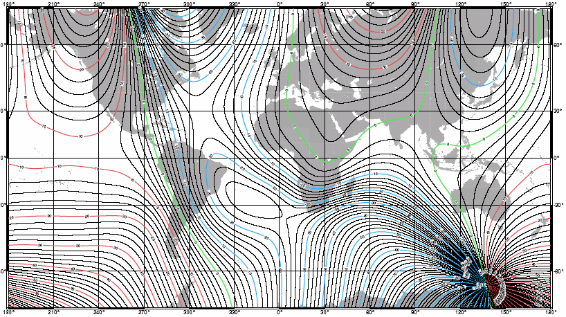
Declination is small in some places and large in others. Along a narrow band called the agonic line, declination is zero, and the compass points at true north with no correction. Elsewhere, the gap can reach 20 degrees or more, which is enough to miss a target by a wide margin over a long hike.
At very high latitudes, the picture breaks down further. The USGS notes that at very high latitudes, the compass can even point south.
Near the magnetic poles, the horizontal part of the field shrinks, and the needle loses its steady north pull. Navigators in those regions rely on gyrocompasses, GPS, and sun sights instead.
The gap also drifts over time, a slow shift called secular variation. A declination value from ten years ago for the same spot can be off by several degrees today.
The wandering pole
The magnetic north pole does not stay put. In the early part of the 20th century, it drifted at about 9 kilometres per year.
The rate started rising in the 1970s, and the pole now moves at about 41 kilometres per year. The magnetic south pole, by contrast, stays fairly stable.
That drift matters because maps, phones, and aircraft all use magnetic models. NOAA maintains the World Magnetic Model, which supplies declination values for any point on Earth's surface. The model usually updates every five years, but the fast pole drift forced an out-of-cycle update in 2018, when the older model degraded in high latitudes, especially for vessels in the Arctic.
Phones carry a version of the model inside them, and apps draw on it when they need a compass reading. The drift affects lower latitudes far less, so a phone compass stays useful for everyday use. Still, the model behind it needs regular updates, and the pole shows no sign of slowing down.
How to correct for declination
Correcting a compass is simple once you know the local value. NOAA gives the rule: compute the true bearing from a magnetic bearing by adding the magnetic declination to the magnetic bearing. East declination counts as positive, and west declination counts as negative.
Work through an example. Suppose your compass shows a magnetic bearing of 45 degrees, and local declination is 10 degrees east. Add 10 to 45, and the true bearing is 55 degrees.
Now suppose declination is 10 degrees west, which counts as negative 10. Add negative 10 to 45, and the true bearing is 35 degrees. The same rule works in reverse: subtract declination from a true bearing to get the magnetic bearing to walk.
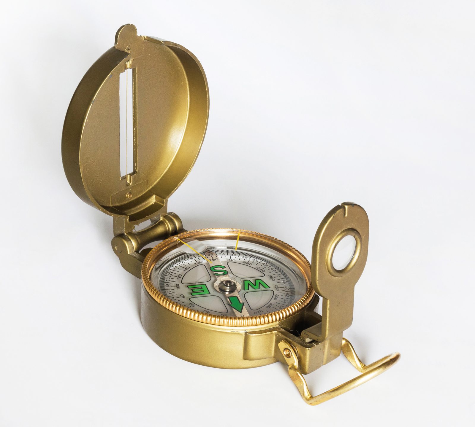
Many baseplate compasses carry an adjustable declination screw. Set it once for your area, and the needle housing reads true north directly, so you stop doing math on the trail. Check the setting when you travel to a new region, since the value changes with place.
Get a fresh value before any trip that relies on a compass. NOAA runs an online calculator that estimates declination for any longitude, latitude, and date. USGS topographic maps print the declination at the map center for the year the map was made, which is useful as a cross-check, but the calculator is the fresher source.
Compass mistakes that cost distance
The costliest mistake is ignoring declination. A 10-degree error sounds small, yet over one kilometre it puts you about 175 metres off your line.
The second mistake is trusting an old declination value. Secular variation shifts the number year by year, so a value from an old guidebook or an old map can mislead. Always pull a current value for the trip date.
The third mistake is carrying the compass near metal or electronics. A phone, a knife, a belt buckle, or a car dashboard bends the local field and drags the needle off. Hold the compass flat, level, and away from metal, and step away from vehicles and fences before taking a bearing.
The fourth mistake is reading a compass that is not level. A tilted compass lets the needle drag on its pivot, and the reading sticks. Keep the baseplate flat and let the needle settle before you read it.
The fifth mistake is mixing up the two norths when switching tools. Paper maps use true north, while a compass reads magnetic north. Pick one north for the whole trip, and convert every bearing to it.
Compasses, maps, and GPS together
A compass still earns its place beside GPS. Batteries die, screens crack, and signals vanish in canyons and thick forest. A compass needs no power and works in any weather, which is why mountain rescue teams and sailors still train with one.
The practical system is simple. Carry a paper map, a baseplate compass, and a phone or GPS as a backup. Set the compass declination for the area, or keep the correction in your head with the add-east rule.
A compass also belongs in the same kit as sun protection and eye protection for bright days, including sunglasses for snow versus water glare when the route crosses snowfields or open water. Navigation and sun care both fail quietly, so both deserve a place in the pack.
Declination even matters beyond hiking. Surveyors, drillers, pilots, and sailors all correct for it. The World Magnetic Model reaches from one kilometre below the surface to 850 kilometres above it, covering ships, aircraft, satellites, antennas, and handsets.
Frequently asked questions
Does a compass needle point at the magnetic north pole?
No. The needle lines up with the horizontal part of the magnetic field at your location. It points roughly toward magnetic north, but it does not aim at a single point on the map.
What is the difference between magnetic north and true north?
True north is the geographic North Pole, where the rotation axis meets the surface. Magnetic north is the direction a compass needle points. The angle between them is magnetic declination.
How do I correct my compass for declination?
Add declination to the magnetic bearing to get the true bearing. Treat east declination as positive and west declination as negative. For example, a 45-degree magnetic bearing with 10 degrees east declination gives a 55-degree true bearing.
Why does declination change over time?
Earth's magnetic field shifts as the outer core moves, a slow drift called secular variation. The magnetic north pole now wanders about 41 kilometres per year, so local declination values go stale within years.
Can I trust my phone compass instead?
A phone compass works for rough directions, since it carries a version of the World Magnetic Model. It still needs calibration, it drifts near metal, and it dies with the battery, so carry a real compass on serious routes.
The bottom line
A compass needle points north because it lines up with Earth's magnetic field, which runs roughly north and south. True north and magnetic north differ by the angle called magnetic declination, which varies by place and drifts over time.
Look up the current value, add east or subtract west, and the compass becomes a precise tool again. The pole will keep wandering, but the correction stays simple: one angle, one rule, checked fresh for every trip.
Tags: compass, navigation, magnetic declination, outdoors
Latest in Sports
- How to Fall Safely When Skateboarding or Snowboarding
- How to Choose Sunglasses for Snow vs Water Glare
- Why Do Goggles Fog Up and How Do Anti-Fog Coatings Work
Subscribe for one practical sports guide in your inbox each week.
Related stories

Why Is Altitude Sickness Worse for Some People?
Altitude sickness hits some people harder because of genetics, ascent speed, and prior history, not fitness level. Here is what raises risk
Why Do You Get Blisters When Hiking and How to Prevent Them
Friction plus moisture plus heat equals a blister. Learn why hiking breeds all three, and the boots, socks, and tape system that keeps
How to choose hiking boots for beginners: fit, features, and break-in
Beginners should buy for fit first: snug everywhere, tight nowhere, with a thumb's width at the toes. Here is how to size, test,